今日の風流
今日のNOAA衛星画像です。東京で受信した画像を自動に表示しています。
2001年からの各月の画像は、こちらのリンクからご覧下さい。
[上空800kmからの受信]
気象衛星の受信を始めたい方へ、その案内があります。
簡単なアンテナと受信機、それとコンピュータが手元にあるならば、簡単に画像を表示できます。
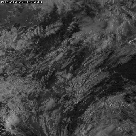
2001年、台風15、16号の様子
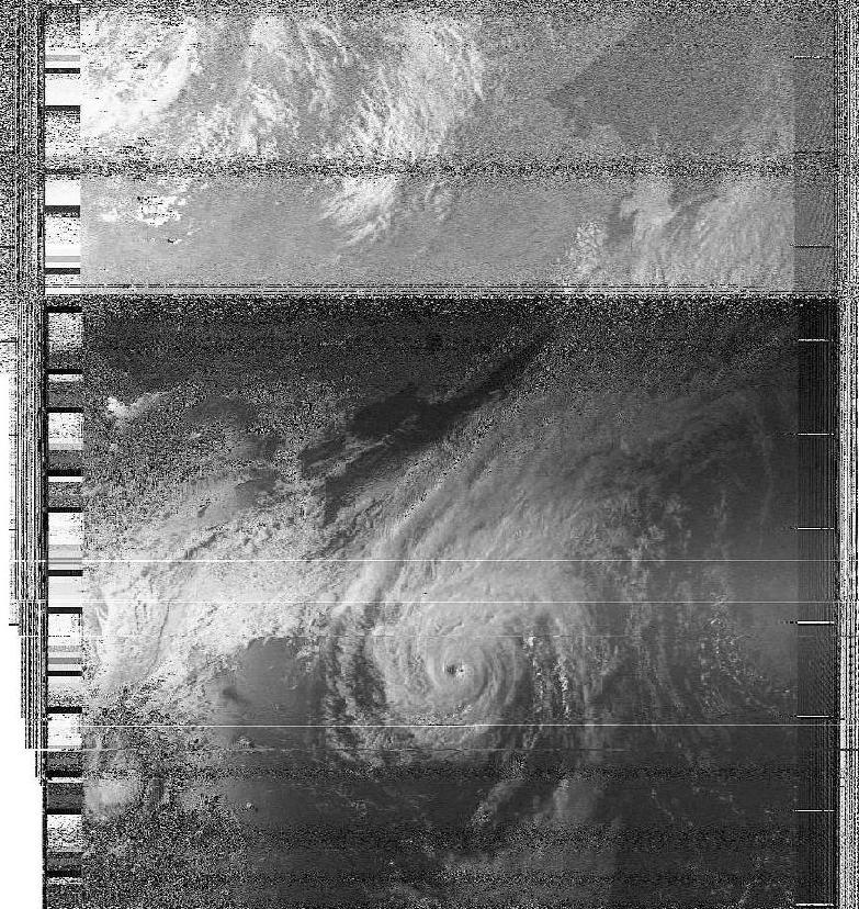
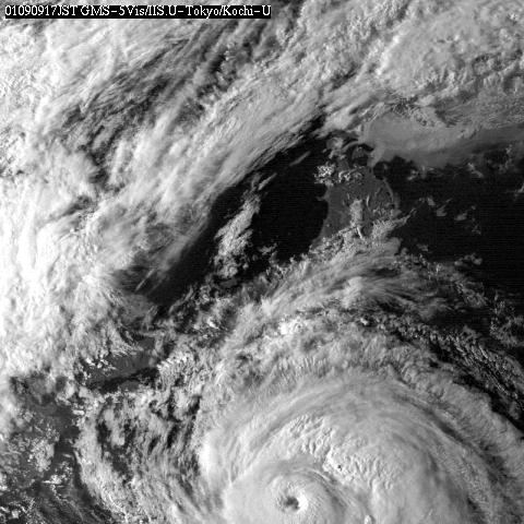
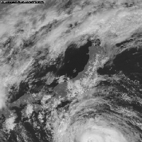
午後4時ころに、四国上空を通過した「NOAA」の可視光画像です。
It is a condition of typhoon 15 and 16.
I pick up pictorial image of being perceivable light of "NOAA" which
passed the Shikoku sky at about 4:00 p.m.
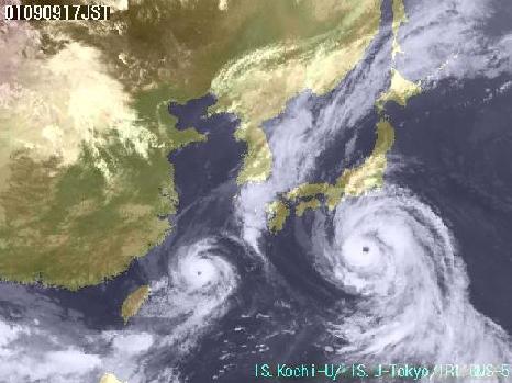
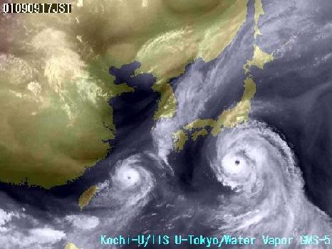
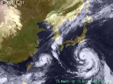
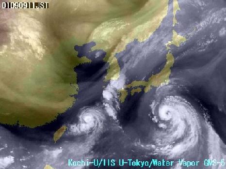
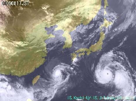
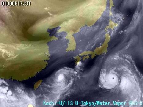
8、9日は、ほぼ同じ時間の「ひまわり」の水蒸気チャンネルと可視光画像です。
On 8th and 9th almost picked up a steam channel of "Himawar" of the
same time and pictorial image of being perceivable light.
「ひまわり」の画像は、高知大学気象情報頁のも
のです。
Pictorial image of "Himawari" is a thing of Kochi University,
Weather Home.
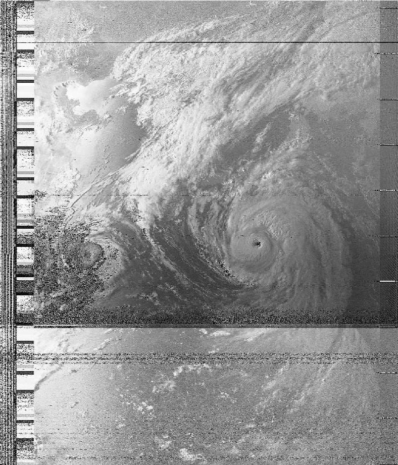
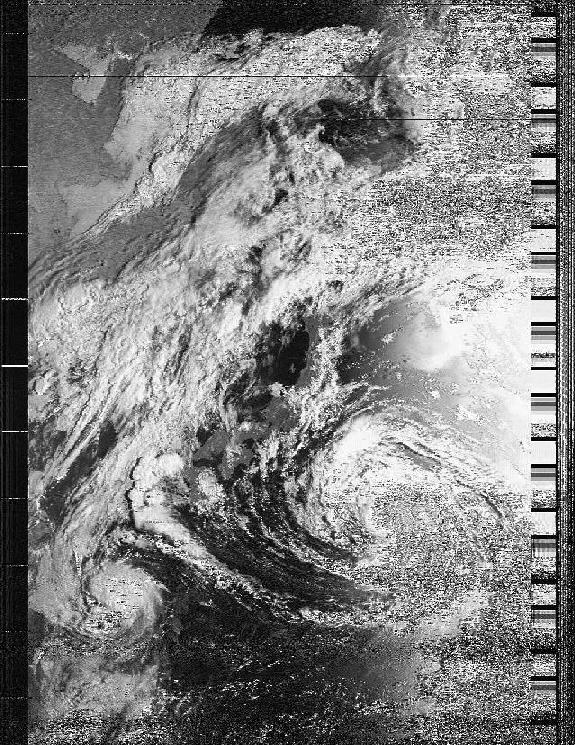
2001年 9月10日 16時30分頃
September 10 about 16:30
台風15号から北東方向へ雨雲が広がっています。
台風の直接な風雨よりも、この雲がもたらす関東や東北地方の大雨に注意が必要でした。
A rain cloud spreads from typhoon 15 through a northeast course.
Word of caution was more necessary for Kanto and a heavy rain of Tohoku
region which this cloud brought than direct wind and rain of typhoon.
三宅島の噴火ガス(二酸化硫黄)の拡散シミュレーションも台風の風の流れが関係しています。
Flow of wind of typhoon is related to a diffusion simulation of
eruption gas(sulphur dioxide) of Miyake-jima Island.
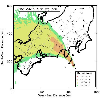
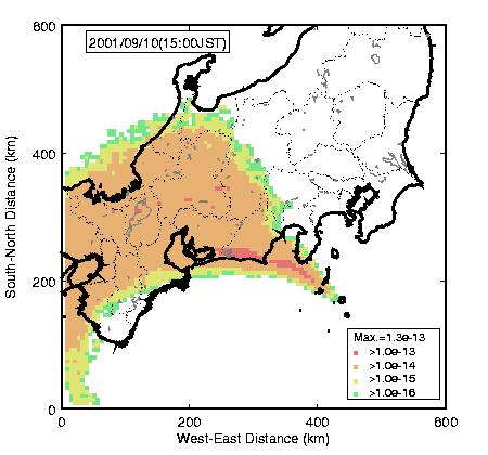
データは、日本原子力研究所 東海研究所 環境科学研究部 大気環境研究グループ
より
Data are Japan Atomic Energy Res. Inst. Tokai research institute
environmental science study part atmosphere environment study group.
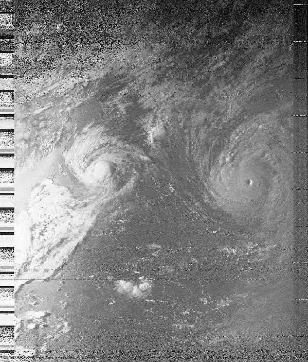
2001年 9月9日 16時50分頃
September 9 about 16:50
NOAA-14画像
同時刻帯の気象衛星ひまわり画像
2001年 9月9日 7時30分 頃
The September 9 7:30 time
NOAA-15 画像
同時刻帯の気象衛星ひまわり画像
2001年 9月8日 17時
September 8 17:00
NOAA-14 画像
同時刻帯の気象衛星ひまわり画像
今日の風流
今日のNOAA衛星画像です。東京郊外で受信した画像を自動に表示しています。
何かありましたら、nakato[at_mark]globe3.ddns.netへご連絡下さい。
[上空 800km からの風景]
[globe3.ddns.net]