気象衛星画像
今日の風流
今日のNOAA衛星画像です。東京で受信した画像を自動に表示しています。
2001年からの各月の画像は、こちらのリンクからご覧下さい。
2001年、台風 17号
It is a picture of typhoon 17
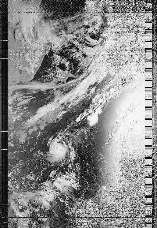
9月19日 7時 September 19 about 7:00
太平洋を通過したNOAA-15号の可視光画像です。
It is visible ray of light pictorial image of NOAA-15 which passed the
Pacific.
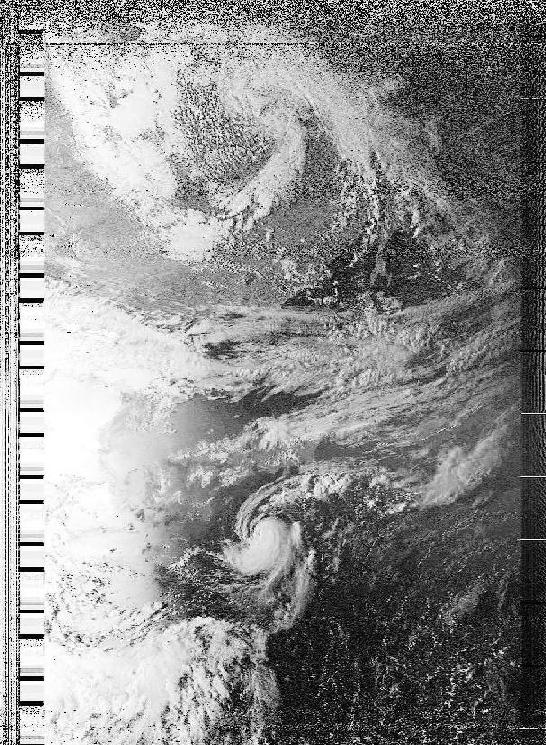
9月19日 17時30分 September 19 17:30
台風17号の北側につながる雲が房総半島にかかっています。
A cloud leading to the north side of typhoon 17 is built at Boso-hanto
Peninsula.
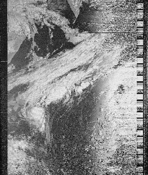
9月20日 6時30分 September 20 6:30
房総半島へは上陸しないようです。台風本体の雲よりも、
前線の雲と東側(画面右側)にある高気圧の縁の雲のために曇っていたり雨が降っているようです。
A cloud of relationship of one high atmospheric pressure lets you go
down rain than a typhoon with a cloud of front east and dances.
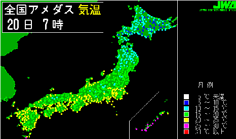
同時刻の気温です。台風が秋を運んでいます。データ元は、防災気象情報サービスアメダス
です。
It is temperature of the same time.A typhoon carries autumn.
今日の風流
今日のNOAA衛星画像です。東京郊外で受信した画像を自動に表示しています。受信機の調整をしていますので、新しい画像が無いこともあります。
何かありましたら、nakato[at_mark]globe3.ddns.netへご連絡下さい。
[上空800km からの風景]
[globe3.ddns.net]