アンテナのある風景 : 2001' Scenery with an antenna.
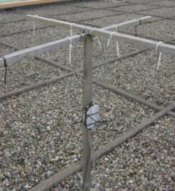
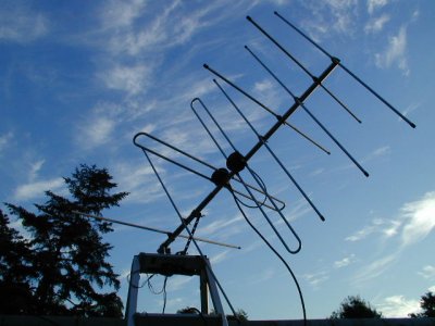
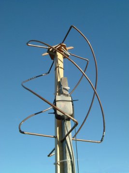
左側がターンスタイルアンテナ。中央が、八木・宇田ターンスタイルアンテナ。右側がQFHアンテナです。
Left side is a die poll Turn Style antenna.The center is Yagi and an
Uda turn style antenna.The right side is QFH antenna.
You can also make these antennas by oneself.
無線機と、マイクインやラインインのあるコンピュータをお持ちの方は、簡
単に気象衛星の画像を手に入れることができます。
「ひまわり」のほかに「RESURS」「METEOR」「NOAA」などの気象衛星があります。
「METEOR」と「RESURS」は、高分解能光学センサを搭載するロシアの気象衛星です。
「NOAA」は、アメリカ海洋大気庁(National Oceanic andAtmospheric
Administration)が運用している気象観測衛星です。略称は「ノア」です。
低軌道を周回している気象衛星は、いつも同じ地域を観測できるわけ
ではありませんが、「ひまわり」よりも鮮明な画像を得られます。
送信はリアルタイムですので、今現在の画像を見ることができます。
There is meteorological satellite of "RESURS" "METEOR" "NOAA" other
than "METEOR" and "RESURS" are satellites of Russia.
"METEOR" is the meteorological satellite, "RESURS" is a satellite
carrying high resolution optics sensor.
"NOAA" is the weather observation satellite which America ocean
atmosphere agency (National Oceanic andAtmospheric Administration)uses.
Meteorological satellite going around low orbit can never observe the
same areas.
However, it is got clear pictorial image than a sunflower Because
sending is realtime, we can look at a current picture now.
If you have radio and a computer with a microphone inn and a line inn,
you can easily obtain pictorial image of meteorological satellite.
But adjustment is necessary to get clear pictorial image. Because
adjustment is not enacted as for the pictorial image which we
received,
there is much noise and gray color is not neatly. Time of adjustment is
necessary to get clear pictorial image.
[go to Scenery from 850km] [go to site top] [上空800kmからの風景] [サイトトップ]
今日の風流
今日のNOAA衛星画像です。東京で受信した画像を自動に表示しています。
2001年からの各月の画像は、こちらのリンクからご覧下さい。
[上空800kmからの受信]
気象衛星の受信を始めたい方むきに、その方法を書いています。
簡単なアンテナと受信機、それとコンピュータが手元にあるならば、簡単に画像を表示できます。
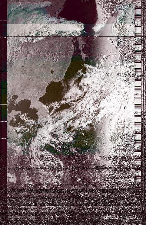
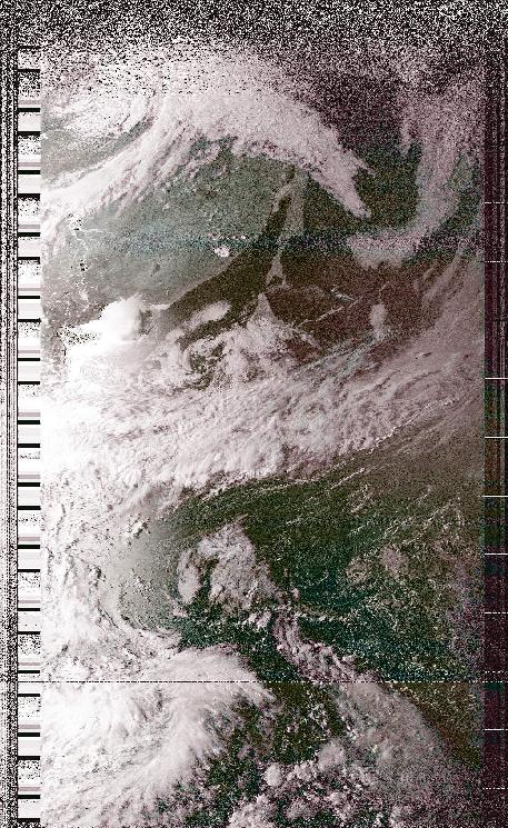
2001年9月13日 7時30分頃
台風16号から本州、北海道に続く秋雨前線の様子が見られます。この画像は、コントラストを上げる処理をしています。
September 13 about 7:30.
A condition of autumnal rain front to continue to Honshu, Hokkaido from
typhoon 16 is found.This image does process to make contrast.
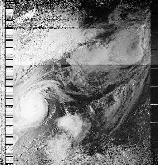
2001年9月13日16時頃
太陽光線の角度が、雲の立体を見るのに丁度良い時間です。
秋雨前線の雲の陰が見られて、雲が厚い部分で大雨を降らせている個所が分かります。疑似カラーにする処理をしています。
September 13 about 16:00.
Solar altitude is the time that is just good to examine a solid of a
cloud. This image does process to turn into pseudo color.
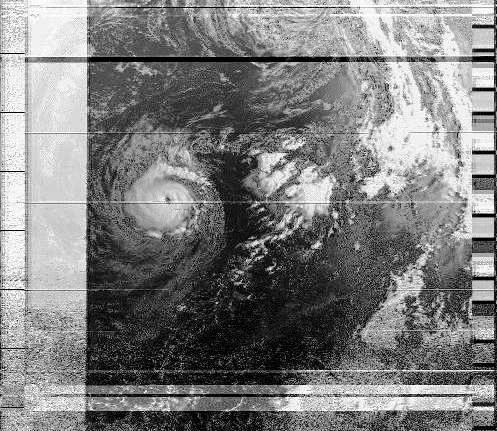
2、3回受信を試した時の台風12号から東側の映像です。初めて捕らえた台風の様子に感激でした。細かい雲の様子もわかります。
It is a picture of the East from typhoon 12 at having tested two or
three times reception.
We were moved with pictorial image of typhoon that we caught for the
first time.
I understand a condition of a small cloud.
午後3時頃 台湾の北東にある台風11号付近の様子
About 3:00 p.m. Typhoon 11 that there is northeast of Taiwan.
今日の風流
今日のNOAA衛星画像です。東京郊外で受信した画像を自動に表示しています。受信機の調整をしていますので、新しい画像が無いこともあります。
It is today's NOAA satellite picture. The picture which received in
Tokyo is displayed automatically. Since the receiver is adjusted, there
may be no new picture.
[go to Scenery from 850km] [go to site top]
[上空 800km からの風景]
[globe3.ddns.net]